UN
4 Gordon Road
£ 235,000
Description
We don't have a Description for this property.
- Bedrooms
- 3
- Bathrooms
- 0
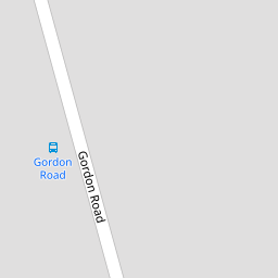


Leaflet © OpenStreetMap contributors
The heatmap indicates the level of crime in the area. The color of the heatmap indicates the crime severity and recency.
Metrics Year-on-Year
- Average area value
- 608,333.00 £Increased by 6.80 %
- Average area rental value
- 1,350.00 £/moDecreased by 40.29 %
- Est rental Yield
- 2.66 %Decreased by 44.12 %
- Crime Rate
- 38.00 %Unchanged by 0.00 %
from 569,577.00 £
from 2,261.00 £/mo
from 4.76 %
from 38.00 %
Nearby Schools
| Name | Type | Ofsted | Distance |
|---|---|---|---|
| Horndon Children'S Centre P3-3 | Children's Centre Linked Site | 0.52 KM | |
| Horndon-On-The-Hill Cofe Primary School | Academy Converter | 0.53 KM | |
| St Clere'S School | Academy Converter | Good | 2.57 KM |
| St Joseph'S Catholic Primary School | Academy Converter | 3.10 KM | |
| Stanford Childrens Centre P2-6 | Children's Centre | 3.50 KM |
Images
Nearby Streets
| Name | Average Price | Average Sqft | Distance |
|---|---|---|---|
| By-Pass Road | £ 0 | 0 | 0.00 KM |
| North Hill | £ 3,500,000 | 0 | 0.00 KM |
| Sandown Close | £ 425,000 | 0 | 0.00 KM |
| James Court | £ 230,000 | 0 | 0.00 KM |
Nearby Transport
| Name | NLC | TLC | Distance |
|---|---|---|---|
| Stanford-Le-Hope | 7458 | SFO | 2.71 KM |
| East Tilbury | 7471 | ETL | 4.57 KM |
| Laindon | 7445 | LAI | 5.52 KM |
| Basildon | 7494 | BSO | 7.93 KM |
| West Horndon | 7466 | WHR | 8.24 KM |
Nearby Listings
| Address | Price | Type | Score | Distance |
|---|---|---|---|---|
| Victoria Road, Horndon-On-The-Hil | £ 280,000 | BUY | Unknown | 0.08 KM |
| Victoria Road, Horndon-On-The-Hill | £ 375,000 | BUY | 6 / 10 | 0.15 KM |
| Victoria Road, Horndon on the Hill, Essex, SS17 8NA | £ 15,000 | BUY | 5 / 10 | 0.15 KM |
| Hillcrest Road, Horndon-on-the-Hill | £ 700,000 | BUY | 8 / 10 | 0.24 KM |
| Hillcrest Road, Horndon-On-The-Hill, SS17 | £ 500,000 | BUY | 8 / 10 | 0.25 KM |
Nearby Properties
| Address | Price | Distance |
|---|---|---|
| 39 Gordon Road | £ 36,650 | 0.00 KM |
| 4 Gordon Road | £ 235,000 | 0.00 KM |
| 6 Gordon Road | £ 265,000 | 0.00 KM |
| 25 Gordon Road | £ 294,995 | 0.00 KM |
| 2d Gordon Road | £ 365,000 | 0.00 KM |